GeoTIFF Tools 1.0

Free With this application you can input TIFF or you can output GeoTIFF
Rating
Your vote:
Latest version:
1.0.0.1 See all
Developer:
Frank Warmerdam
Screenshots
1 / 1
Freeware
Used by 1 person
Download
Free   444 KB

GeoTIFF represents an effort by over 160 different remote sensing, GIS, cartographic, and surveying related companies and organizations to establish a TIFF based interchange format for georeferenced raster imagery.
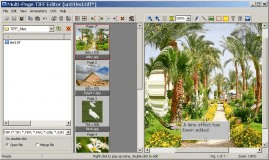
GeoTIFF Tools GUI has a user friendly interface, from which you can input TIFF( for example from Photoshop), or you can output GeoTIFF.

Comments

User

Your vote:

Related software

DCE Tools
DCE Tools
rating

DCE Tools Essentials bundle is a series of seven professional Photoshop plugins.

NXPowerLite
NXPowerLite
rating

Compress your images and documents to save space and improve your file sharing.

GEO Spider
GEO Spider
rating

It can analyze and trace all network applications on the fly

PowerShrink
PowerShrink
rating

File compression software for PDF, PowerPoint, Word, etc.

Multi-Page TIFF Editor
rating

Multi-Page TIFF Editor it is a tool to work with documents in TIFF format.

Related suggestions